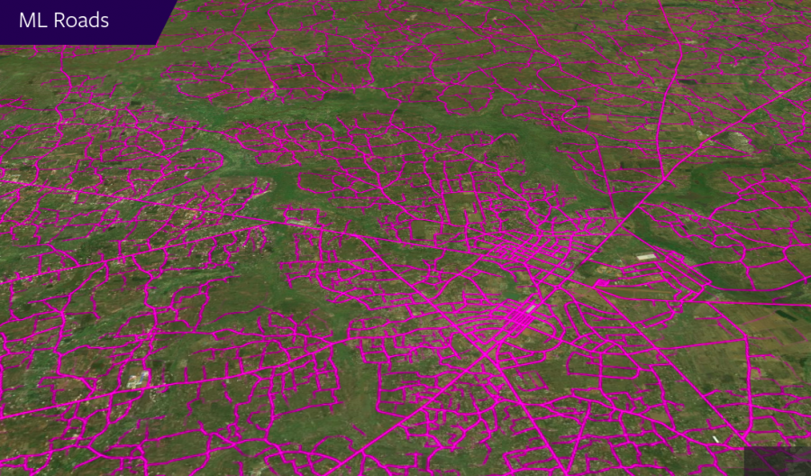
Researchers have released details of a new method for generating maps and
predicting road networks using deep learning and satellite images.
The new method achieves state-of-the-art results in terms of accuracy of the road network predictions and mapping. Researchers used high-resolution commercially available satellite imagery and leveraged the power of weakly supervised learning to push the boundaries of road mapping research.
The proposed method incorporates two major parts: road segmentation and weakly supervised training for obtaining global scale. For the first part, the researchers used recent advances in semantic segmentation using fully convolutional deep neural networks. The results obtained from the semantic segmentation were post-processed and vectorized to obtain road vectors compatible with common geospatial databases. Weakly supervised learning techniques were used to obtain (imperfect) training data and train models which will be able to identify roads and output road networks.
Facebook AI Research also released a new set of specialized map-editing services and tools – “Maps With AI”. The set uses the trained models to provide mapping data and it serves as a playground for the global mapping community of researchers. Map With AI has a user-friendly editor interface called RapiD, that allows researchers to verify the automatically generated maps and modify and adjust them according to their needs.

Since mapping is a challenging problem, the idea behind “Maps With AI” is to bring AI-powered tools for efficiently generating maps instead of providing (often inaccurate) automatically generated maps.