NASA and IBM have unveiled the open-source model Prithvi, designed to empower scientists in tracking the consequences of climate change, monitoring deforestation, predicting agricultural crop yields, and analyzing greenhouse gas emissions.
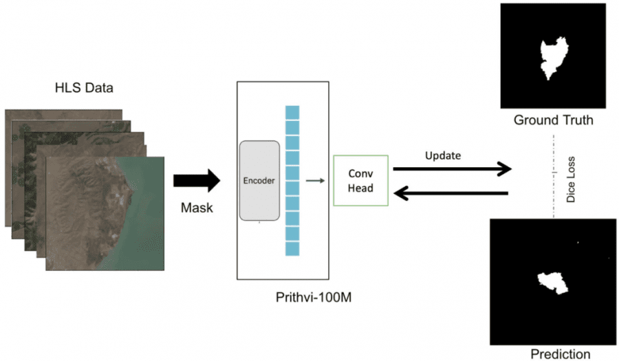
As part of the NASA Harmonized Landsat Sentinel-2 (HLS) mission, Earth’s satellite images are collected with an exceptionally high spatial and temporal resolution: 30 meters per pixel every two to three days. Such granular data precision facilitates in-depth analysis of a wide array of ecological phenomena.
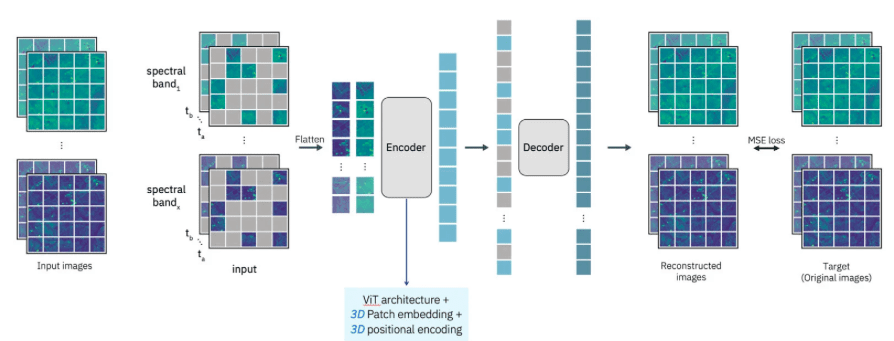
IBM harnessed its cloud platforms, such as WatsonX, to train the model using NASA’s data. Prithvi, a visual transformer with temporal resolution, was employed. The model incorporates a self-attentive encoder with Mean Squared Error (MSE) as the loss function. Prithvi takes remote sensing data in video format as input and performs pixel segmentation in accordance with the specified task. For instance, the model can identify fire and flood areas, as well as distinguish regions with various land cover types.
Based on the output data, the capability to analyze the causes, dynamics, and propagation parameters of specific phenomena arises, enabling the construction of forecasts regarding the further spread of identified areas. Initially configured to identify fire and flood zones, the model can be adapted for diverse tasks through additional configuration.
Watch the Prithvi Model in Action
Pritvhi along with the satellite data from IBM and NASA are accessible on the Hugging Face platform. This stands as the most comprehensive open geospatial model available at present.